
[an error occurred while processing this directive]

Today@Sam | Headlines | Calendar | Experts | Notices | Archives | Search
Differing Fields Converge to Research
Hula Dancing
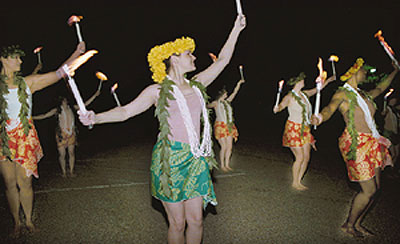 |
While movie stars of the post World War II era may have popularized this art, Cindy Gratz, Sam Houston State University associate professor of dance, and Richard Rush, Geographic Information Systems coordinator (GIS), are setting the record straight regarding the history of hula dancing.
Gratz and Rush have collaborated in a project, The Hula Diaspora, which traces the dissemination of Hula from Hawaii to Texas. They will present their research findings at the World Dance Houston: Exploring the Global Heritage of Dance event at the Houston Community College central campus in July.
Accompanying Gratz and Rush to the presentation will be two SHSU student research assistants, several SHSU dance students, two SHSU student percussionists, and members of the SHSU Department of Military Science.
Using technology provided by GIS, the dance department and the Texas Regional Institute for Environmental Studies collaborated with research that complimented both fields. These two seemingly unrelated fields were able to successfully complete a research project by being "open-minded" explained Rush. "With the right commitment from both sides," he said, "GIS was able to be beneficial to the arts just as it has been for the sciences."
A Geographic Information System (GIS) is a spatial reference technology that allows the generation and integration of disparate data sources into a unified management support tool. GIS consists of computer hardware, software, and trained personnel that can collect, store and manipulate large amounts of data.
GIS differs from a map because the system has an extra level of information. With a map, a stream is just a stream. However, with GIS a click on the stream can reveal flow rate, contamination levels and even an associated ecosystem.
The Hula Diaspora studies the dispersion of hula dance training and performance by charting the relationship of military sites in three time zones to locations of hula "halaus" (schools of hula training). Research showed Hula began prior to 1800, when the history, genealogy, and religious beliefs of Hawaiians were kept alive through chants and dances and were interpreted during sacred or social ceremonies.
In the mid 1800s, parents and teachers of small groups protected their "sacred" dances by pronouncing them "kapu" or prohibited. Dancers were encouraged by King David Kalahaua in 1885 to rediscover their cultural heritage and Hawaiians began lifting the kapus.
After World War II, there was a resurgence of Hawaiian dance. "Auwana" (wandering) hulas were presented as a welcome to tourists and sailors. It was during this period that Hula became a form of entertainment and an important aspect of the tourism industry in Hawaii.
During the 1970s, there was a Renaissance of Hawaiian dance. It became a cultural symbol and expression of the values and traditions of Hawaii and continues today.
The Hula Diaspora shows how the dancing rituals spread to Texas. WWII was one of the direct links to bringing both hula teachers and dancers to Texas and the mainland. After the Hula Renaissance, hula teaching, dancing, and performing appeared to radiate from the military sites outward throughout Texas and Hawaii.
Today, hula teachers can still be found throughout Texas, but most are clustered around military sites such as San Antonio, Killeen, Wichita Falls, El Paso, and San Angelo, according to the research.
Gratz said the presentation of the research findings has been difficult because she is trained as a dancer and, "dance is usually a non-verbal form of communication."
To aid in the presentation at HCC, a hula class demonstrating differences between hula training before and after the Renaissance will be conducted where basic "kahiko" (ancient) footwork will be learned.
Gratz and Rush have also been invited to present their study at the Congress on Research in Dance (CORD) Conference at New York University in October.
"The idea that a traditionally non-technical related field can utilize this form of technology to further its growth and knowledge base is an ideal application for GIS research," said Rush. "GIS is an under utilized technology that has applications in almost every academic field."
Both individuals feel that they have gained a lot from working together. Gratz credited Rush's "resourcefulness" for the success of the project.
"The knowledge and experience of working outside one's field can be extremely rewarding," said Gratz.
- END -
Research Conctact: Cindy Gratz at 294-1311.
Research Contact: Richard Rush at 294-3976.
SHSU Media Contact: Audrey Wick
May 10, 2001
Please send comments, corrections, news tips to Today@Sam.edu
This page maintained by SHSU's Office of Public Relations
Director: Frank Krystyniak
Communications Coordinator: Julia May
Located in the SHSU University Advancement Building
Telephone: 936.294.1836; Fax: 936.294.1834